The Northern Trek is now available on Hiiker, one of the world’s leading long‑distance hiking apps.
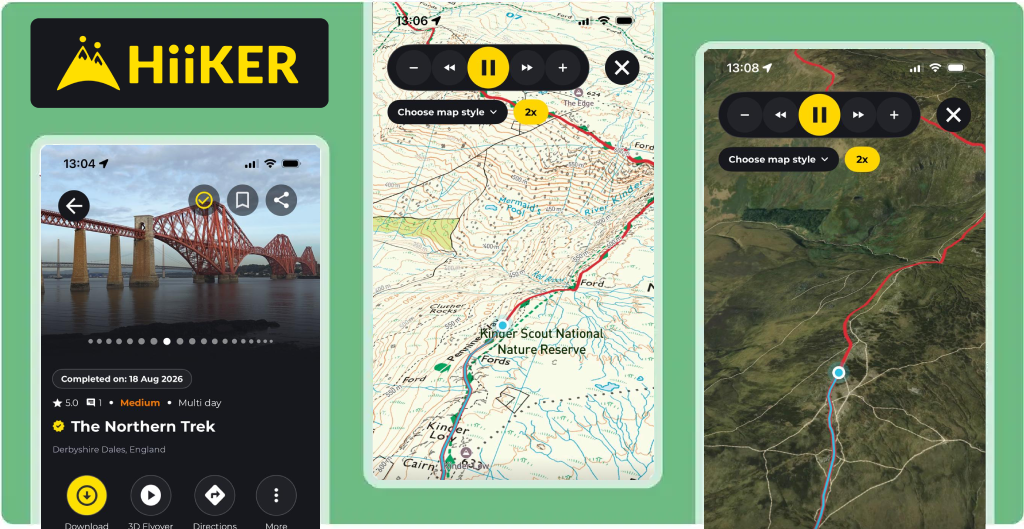
Every stage of the route from the rugged Pennine moors to the sweeping Cheviot ridgelines can now be followed on your phone with detailed mapping, elevation profiles, waypoints, offline navigation, and immersive 3D flyovers of the entire route.
This is a huge milestone for the Northern Trek. Ken has always wanted the Trek to be accessible to as many walkers as possible, and Hiiker’s platform brings the whole journey to life with clear, reliable, easy‑to‑follow digital guidance.
Whether you’re planning your first section or tackling the full end‑to‑end adventure, Hiiker gives you everything you need in your pocket.
Hiiker has the following features:
Accurate GPX & mapping for every stage
Offline navigation for remote areas with limited signal
Elevation profiles to help you plan your day
Waypoints & points of interest across the route
3D flyovers showing the full route from above... perfect for planning and visualising each stage
Safety features including location sharing
Available worldwide on both iOS and Android
Hiiker is free to download and works on both Apple and Android devices. Here’s how to get it:
Open the App Store
Search for “Hiiker”
Tap Download
Open the app and search for “Northern Trek”
Save the route and explore the 3D flyover before you head out

Open the Google Play Store
Search for “Hiiker”
Tap Install
Open the app and find “Northern Trek”
Add the route to your library and enjoy the 3D flyover preview