The Northern Trek is now broken down into 32 single days.
Working closely with Ordnance Survey, each of the day routes can now be downloaded to your GPS device in .gpx format.
32 sections with route description, elevations and a stunning fly through of each days walk. Beautiful photographs and thousands of way points to help you navigate this amazing 560 mile new hike.
If some of the days hiking look a bit long for you, then just spread them out over a couple of days. It's not a race.
Click on any of the links below to open that section in the Ordnance Survey website.
![]()
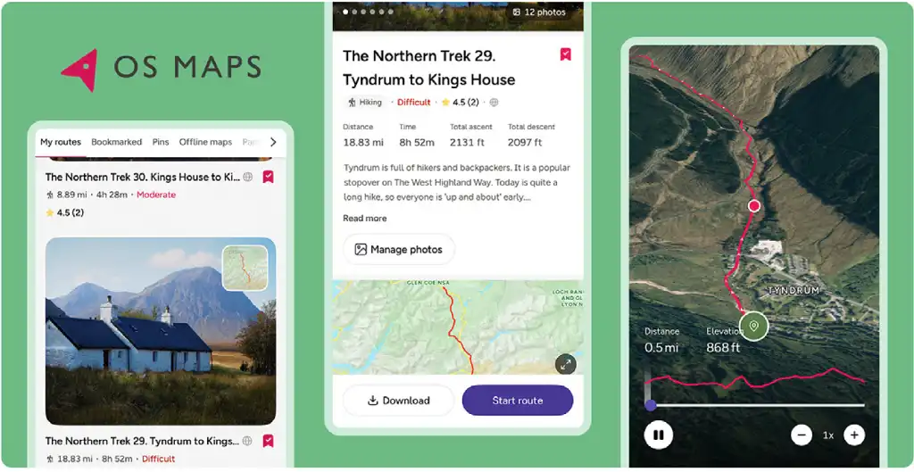
The Northern Trek is now broken down into 32 single days.
Working closely with Ordnance Survey, each of the day routes can now be downloaded to your GPS device in .gpx format.
32 sections with route description, elevations and a stunning fly through of each days walk. Beautiful photographs and thousands of way points to help you navigate this amazing 560 mile new hike.
If some of the days hiking look a bit long for you, then just spread them out over a couple of days. It's not a race.
Click "View route details" for more information about each section.
To install the OS App, simply download it from the Apple App Store (for iOS devices) or the Google Play Store (for Android devices). The app is free to download, but accessing certain maps or features may require a subscription or purchase
Click the relevant app store button below for your device:
![]()
![]()